
Looking Up Your Tooele Neighbors by Block
A block lookup starts with one address and expands to nearby parcels, roads, municipal boundaries, and public civic activity. Tooele County GIS can show the surrounding geography, while EagleWeb can identify indexed owner and mailing fields for a parcel. Those sources do not reveal every household member or prove who lives at a place. Treat the block as a map of records, with each source labeled by purpose and date.
| Source | What It Shows About a Block | Access |
|---|---|---|
| Tooele County GIS | Adjacent parcels, address points, roads, districts | Free viewer and REST layers |
| EagleWeb property roll | Indexed owner, mailing/situs fields, parcel facts | Public limited search |
| Utah voter records | Lawful public fields or own status | Self route or defined request |
| City public notices | Planning, zoning, hearings, parcel references | Public document pages |
| Community programs | Block-party and prevention contacts | Participation, not roster |
An owner or mailing field can suggest a property connection, but it does not establish occupancy. The Utah voter privacy page protects full birth date, ID, Social Security number, email, phone, and signature, and at-risk records can be withheld. A neighborhood result should therefore describe place and public activity rather than publish a list of private people.
Tooele Neighbors Through County GIS
The County Interactive Map and REST catalog include AddressPoints, AddressingGrids, Municipalities, maintained roads, land ownership, county council districts, and general-plan land-use. Start at a known address, identify the parcel, then click outward to the parcels that touch or sit near it. Compare the map’s municipality and road layers with EagleWeb’s situs and legal description.
The map is spatial context, not a people search. Recent splits, annexations, boundary-line agreements, or stale layer dates can change the apparent relationship between a parcel and a road. Save the layer name and date, and use the Recorder for an instrument that explains a boundary change.
Useful layers answer different block questions. AddressPoints help locate a situs point, AddressingGrids explain the city’s road system, Municipalities show jurisdiction, and maintained-road layers help distinguish a public road from a parcel edge. Land-ownership and general-plan layers add planning context. The statewide parcel documentation also includes source, current-as-of, tax-district, acreage, building, and subdivision fields, but those are parcel attributes rather than proof of who lives there.
If the map and the property card disagree, do not average the two results. Record the parcel ID, situs, legal description, layer date, and related-parcel link, then ask the County GIS or Recorder which artifact controls the question. A block boundary built from a road centerline may not match a title boundary, and a recent public notice may be the first sign of an annexation or subdivision change.
Open the Tooele County Interactive Map to inspect a block’s parcel context.
Tooele Neighbors and Community Programs
Tooele City’s Neighborhood Block Parties program offers free indoor community-center parties at 102 N 7th St and summer parties from May through October at neighborhood or center sites. Sandy Medina is listed as coordinator at sandym@tooelecity.gov and (435) 843-2187, with a city contact at 255 S 100 E. Invitations may be delivered to homes, and participants pre-register with photo-consent language.
The Police route for Neighborhood Watch and prevention questions is (435) 882-8900, with dispatch at (435) 882-5600. These are ways to participate in a block or ask about safety, not public neighborhood directories. Do not infer that an invitation or program contact identifies everyone nearby.
Tooele Neighbors in Civic Geography
City public notices can show where zoning, annexation, overlay, subdivision, and hearing activity touches a block. A recent notice dated August 31, 2026 concerned removing the Sensitive Area Overlay around approximately 695 S Main and 598 S Canyon. Earlier notices involved land near 1200 W 700 S and a home-occupation or childcare hearing near 647 E 980 N. These are parcel and process examples, not neighbor lists.
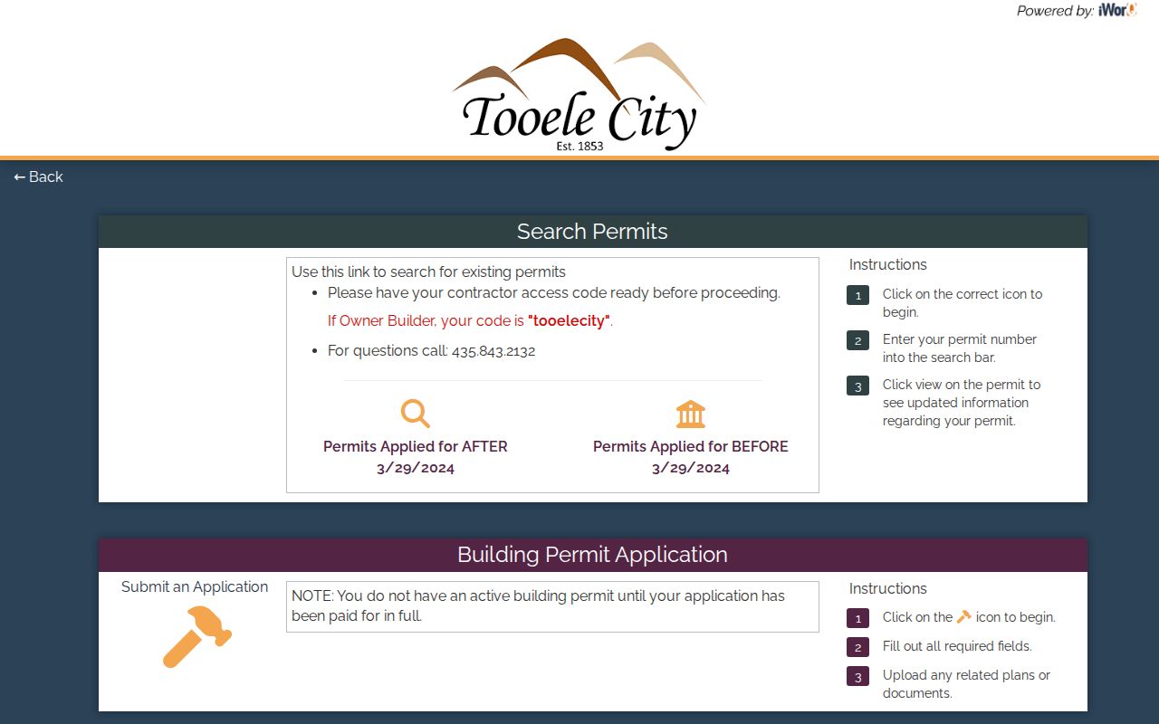
For a permit question, use the Community Development document center or iWorQ, which has separate branches for applications before and after March 29, 2024. A permit can show a public project or parcel number where releasable. Keep the record’s public purpose in your notes.
Tooele City Planning processes subdivisions, commercial site plans, conditional uses, zones, variances, and official zoning or future-land-use maps. Community Development can be reached at (435) 843-2132, and its document center includes annexation petitions, final subdivision plats, property-line adjustments, site plans, and building-permit packets. Those materials can explain why adjacent parcels look different without requiring a list of neighboring households.
A public notice is most useful when it names a hearing, parcel reference, or planning action that can be checked in the map. The August 31, 2026 Sensitive Area Overlay notice, for example, gives dated civic context around 695 S Main and 598 S Canyon. It does not identify the people nearby. Use the notice to locate the public process, then ask the City Recorder or Community Development for the releasable document that answers the land question.
Tooele Neighbors from One Address
A careful neighbor lookup follows a short process. Begin with the address, not a person. Use GIS to identify the subject parcel and adjacent geometry, EagleWeb to read each indexed parcel result, and public notices to explain a current civic change. If the goal becomes the full named-street chain, switch to the Tooele street directory rather than repeating a block map.
- Enter the address in the County GIS viewer and identify the parcel.
- Click the adjoining parcels and record parcel IDs, not private contact data.
- Check EagleWeb for indexed owner, situs, mailing, legal, and value fields.
- Compare municipality, roads, and planning layers for boundary context.
- Use a city notice, permit, or Recorder document when the parcel needs a dated explanation.
Tooele Neighbors and Official Record Limits
Official sources have a named custodian, a record purpose, and an access rule. A county map answers where land lies; EagleWeb answers an indexed property relationship; the voter system controls public and protected fields; a city program supports participation. Commercial people-finder tools often combine stale or unclear sources, may charge for access, and do not turn a profile into verified identity or lawful permission to contact someone.
For a block question, the official route is slower but traceable. Save the source date and use the office’s correction or request path when a result is wrong. Do not copy a private phone, email, full birth date, signature, or protected address into a public note.
Community information can be useful without identifying a household. A city meeting, block party, neighborhood-watch contact, or planning packet tells a reader where to participate or ask a question. It does not authorize a list of nearby people. When a source offers only aggregate or program-level information, keep it at that level.
Map a Tooele Block from Parcels Outward
Adjacent parcels are the most reliable way to define a block in a records search. The GIS viewer supplies the geometry, while EagleWeb supplies parcel and indexed-owner fields. Compare the two before describing a boundary, especially where a road, municipality, or planning layer changes.
- Locate the address in the Tooele County Interactive Map.
- Click the adjoining parcel polygons and save their identifiers.
- Compare EagleWeb owner, mailing, situs, legal, and assessment fields.
- Use city notices or permits for a dated public-process clue.
- Switch to the street walkthrough for a whole-road question.
That keeps the block lookup narrow. The Tooele street directory handles a full street-by-street records chain when the question moves beyond the immediate surroundings. For a historical household question, use the dated collections rather than assuming a current neighbor is tied to an old address.
Privacy Limits on a Tooele Neighbor Lookup
A block map cannot show every household member, a delivery record, or a utility customer. Safe at Home provides eligible Utah participants a substitute address and mail forwarding, and voter at-risk status can withhold or anonymize identifying information. GIS and property data describe parcels, not private people.
The absence of a name, phone number, or exact address may reflect a legal classification, safety program, stale layer, or record purpose. Do not fill that gap with an unsourced profile. Ask the custodian about a correction or lawful request, and contact emergency services for an immediate threat.
Safe at Home gives eligible participants a substitute address and mail-forwarding path, while Utah voter at-risk status can suppress identifying information. A hidden address is therefore not a missing piece to recover. If the research purpose is community participation, use the city’s block-party or Neighborhood Watch contact; if it is a land question, use the parcel, notice, permit, or road artifact instead.
Utah Safe at Home and voter at-risk protections deserve priority over curiosity about a block. If a participant’s address is hidden, preserve that protection. A responsible neighbor lookup can still support a public meeting, a community event, a parcel question, or a safety referral without exposing a protected person.
When a block question needs an official answer, name the artifact rather than the person: a parcel map, permit, notice, road layer, or public meeting record. That gives the custodian a clear request and keeps a neighbor lookup tied to a lawful purpose.
Lawful use. Neighbor research is for civic participation, reconnecting, personal safety awareness, and understanding a place. Do not use it to watch, stalk, threaten, dox, intimidate, or harass anyone. Utah Code §76-5-106.5 addresses stalking conduct.